Waves of potential impact
Climate risk outlook
El Niño is expected to peak around December 2026, becoming one of the strongest events on record. WMO projections indicate sea surface temperature anomalies could reach +3.8 °C in November 2026–January 2027, far above the +0.5 °C threshold commonly used to identify El Niño. The positive Indian Ocean Dipole remains active, with the weekly Dipole Mode Index at +0.73 °C on 1 November and a seasonal mean anomaly of +0.3 °C for November–January. The IOD is expected to weaken and possibly return to neutral by late December or early 2027.
A stronger El Niño does not automatically mean proportionally greater impacts. The severity and timing of drought, extreme heat and flooding depend on how the warming interacts with seasonal rainfall, the IOD and existing soil-moisture and water conditions. The peak in ocean temperatures need not coincide with the peak in impacts, which may emerge or intensify in different countries well into 2027.
This is a seasonal outlook: strongest for the broad climate signal through January 2027 and progressively weaker for country-scale detail, subnational variation and the period after January. National Meteorological and Hydrological Services remain the authoritative, operational source for location-specific forecasts and warnings.
Why waves of potential impact
What matters most is timing. As El Niño approaches its December peak, rainfall shortages carry very different consequences depending on the country and how the timing lines up with its agricultural calendar. Earlier snapshots used tiers to flag the countries at greatest risk at one point in time; the regional analysis uses waves of impact to reflect how El Niño evolves and how risks move across the region.
El Niño moves through development, peak and decay, and its impacts do not appear everywhere at once. Risks may intensify in some countries while easing in others. The waves describe when countries are most likely to see heightened impacts, not which are most at risk overall. Countries can swing from one extreme to the other, drier in one wave and wetter in the next.
Three waves and the seasons they meet
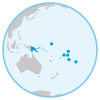 Pacific
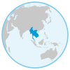 Mainland
South-East Asia
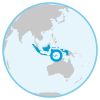 Timor-Leste,
Indonesia
 Afghanistan,
Pakistan
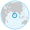 Sri Lanka
Wave 1
November–December 2026 El Niño approaching peak Highest confidenceThe clearest signal is in November–December 2026, when rainfall deficits are already well established across much of the Pacific dry corridor and maritime South-East Asia. At the same time, wetter-than-average conditions are favoured across South-West Asia and parts of the equatorial Pacific. This is when the signal is clearest and confidence highest.
Wave 2
January–February 2027 Persistent risks and geographical expansion Lower confidence · likely to shiftFrom January to February 2027 the dry signal could come into play and deepen across mainland South-East Asia and the Philippines. In the Pacific, Papua New Guinea and Solomon Islands show a possible recovery signal from February 2027, but impacts are likely to continue, depending on the strength of the next wet season. Confidence in the forecast signal is lower in this wave, so the analysis is likely to shift in the coming months.
Wave 3
March 2027 onward Potential El Niño decay and delayed impacts Lowest confidence · provisionalMarch 2027 is the last month covered by the current October 2026 forecast. From March onward the long-range forecast points to further extreme swings between above- and below-average rainfall, with potentially serious impacts. Confidence is lowest in this wave: use it very cautiously, and only for preparedness.